მთავრობამ შეუკვეთა თუ თვითონ?
https://www.google.com/search?q=From+sea+to...chrome&ie=UTF-8From sea to shining sea: a taste of the Transcaucasian Trail
Volunteers are creating a 1,500km trail to link the Black and Caspian Seas
Andrew Eames JULY 26, 2019
We didn’t see the village of Adishi until we were right on top of it, but it was clear that human habitation was nearby. It was mid-afternoon, and we’d descended across the southern flank of saw-toothed Mount Tetnuldi through a tartan of autumnal birch, the September sun strafing the hills with stripes of silver and gold, when the curtain of forest drew apart. Three men were working in the steep meadows below, pitchforking hay on to a sled pulled by two oxen. They leaned on their tools for a moment to watch as we passed.
On the far side of the meadow, the land dipped, and Adishi rose from the bank of the river, bristling with defensive towers, like something out of a film director’s imagination. Close up, it looked ravaged and medievаl. Many of the towers and some of the houses had been wrecked by a stone-splittingly cold winter 25 years previously, and now just 14 families remained, getting by on what they could glean from the land in a place beyond the reach of roads.
These were Svans, an ethnic subgroup with their own distinct language who lead a traditional albeit dwindling existence in the Svaneti region of Georgia’s Caucasus Mountains. In their case, it wasn’t just the conditions that had whittled away at the population; the presence of all those watchtowers spoke of a warlike past that pitted village against village in the struggle to survive.
Now, however, the likes of Adishi were getting a fresh lease of life, from outsiders like us hiking the new Transcaucasian Trail. Ultimately, the plan is to link the Black and Caspian Seas via more than 1,500km of paths through Georgia, Armenia and Azerbaijan — a hike that could take three months to complete. (A second planned trail of similar length runs further south, along the Lesser Caucasus, from the Black Sea to the Iranian border.)
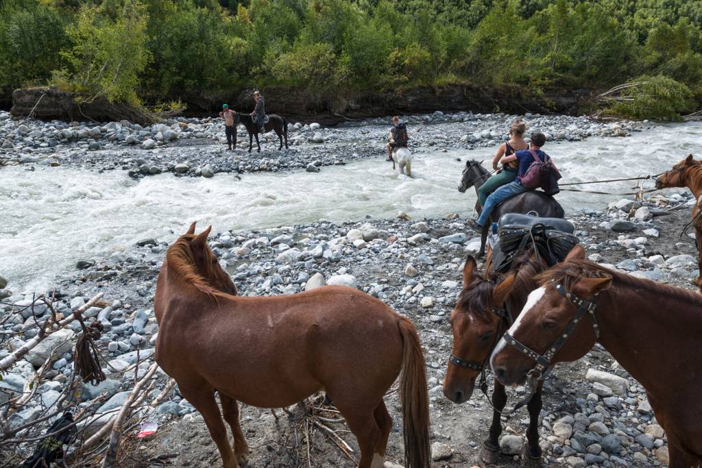
Crossing the river outside Adishi on horseback © Shutterstock
The idea surfaced in 2015 when Paul Stephens, a Peace Corps volunteer from Indiana, started mapping the existing paths in the Georgian Caucasus. In 2016 volunteers began improving sections of path and putting up signage in the Svaneti region. Today, 300km is ready, in sections along the route, and while Stephens and colleagues are recruiting sponsors and volunteers to open up Armenia, the Svaneti remains the longest single section, with 10 days’ worth of hiking already complete. Of that, the four-day part between Mestia and Ushguli has quickly become the most popular long-distance hike in this hitherto little-walked region.
It has certainly opened up the Svaneti, and for subsistence-based communities like Adishi, that means cash. The village is strategically placed at 2,000 metres above sea level, an hour’s walk downriver of a large glacier, and hikers want to overnight here in order to tackle the glacier’s snowmelt river in the morning. There’s no bridge, so the Svans offer river-crossings of the surging ice-cold water with their sturdy, sure-footed packhorses.
There were four of us walking together — my wife and our two adult children — and we were relying on the villages for places to stay and other essentials. Trying a new trail like this carries a lot of unknowns, and I did wonder whether, in a region that has yet to get good maps, we’d end up getting lost; whether we’d go hungry, or even whether there’d be such a thing as hot water.
Fortunately, getting lost was never an issue. The trail turned out to be well trodden and clearly marked with splashes of red and white paint, and it moved steadily from forest to meadow, riverside to ridge, never flat but never gaspingly steep. On the downhills we talked, on the uphills we grunted, and on the ridges we squealed with delight at the volleys of mountains rolling off into the distance, some peaking in snow.
At our journey’s starting point in Mestia, which turned out to be a relatively sophisticated hill resort, we’d pre-booked a guesthouse via booking.com, the universal reservations agency for these remote family-run places. It turned out to be up a hill overlooking town and had a viewing platform where my daughter Rhena could do her yoga in the early morning sun. The clatter of horses’ hooves rose up from cobbled streets below, while falling apples drummed on to the tin roof above.
Over breakfast, son Thomas wheeled out his rudimentary Russian (widely spoken among older Georgians) as our landlady heaped our table with mountains of fried cheese, potato dumplings and plum jam, plus a bag for packed lunch, which answered the “going hungry” question. Bed and breakfast at the Keti Margiani cost just £17 a head.
Approaching Adishi, however, it was clear that the choices were going to be more limited. Several of the houses had primitive signs welcoming hikers, and we plumped for Elizabeth’s Guest House, fronted by a two-storey wood-framed gallery that creaked like a Spanish galleon in the wind. When we arrived, Elizabeth was in the outdoor kitchen making flatbreads on a wood-burning stove and her sister was in the potato field in front of the house, digging. She was expecting a full house, she said, as she showed us the available rooms; autumn was the best season for the trail, partly because of the warm sunshine and golden leaves, but also because storehouses were filled with summer produce, so it wasn’t hard to feed hungry hikers.
And so it seemed. Around the communal table that evening, there must have been 15 of us; Belgians, Spanish, Russians and Brits, tucking into meat soup, fried potatoes, tomato salad and piles of khachapuri, flat breads filled with melted cheese. Elizabeth kept on replenishing, and homemade grappa-like chacha flowed.
There was no chance of a hot shower, however, and we certainly didn’t want a cold swim. Leaving Adishi the next morning, three of us plumped for the safety of the horses to get across the river, which has a reputation for carrying hikers away. Thomas decided to take off his boots and wade, which nearly gave his mother a heart attack.
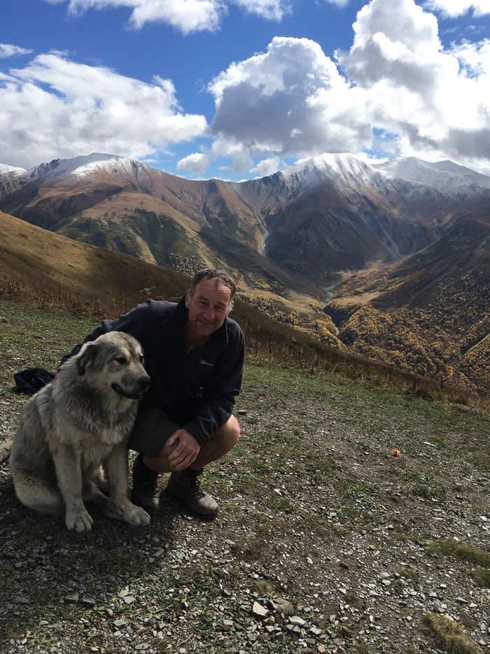
A huge shepherd dog, the Svan equivalent of a St Bernard, joins us on our climb to the Chkhunderi pass
After that came the long haul up to Chkhunderi pass — two hours of hard climbing. A huge shaggy shepherd dog, the Svan equivalent of a St Bernard, had followed us all the way from the village, for reasons that became clear when we reached the top. Here, where a superb panorama of forest-cloaked mountains opened up, we decided to break for our packed lunch — as many a hiker had clearly done before, judging by the demeanour of the dog. When we’d finished ours and he’d had his share, he turned for home.
A day and a half later, we made our entrance into Unesco-listed Ushguli which, at 2,200 metres above sea level, is one of the highest permanently inhabited villages in Georgia, its long history represented in a 12th-century fresco-lined chapel up on a hill behind the village. The community, situated at the confluence of the Enguri and Black rivers, has preserved more than 200 medievаl tower houses, brooding presences that give it a touch of the Mordors when the sun doesn’t shine.
More importantly, as far as we were concerned, it was reachable by road — our exit strategy. That meant more people, more guesthouses, clean sheets, hot showers and WiFi — the return of the modern world after four pure days in the mountains.


